Environmental Earth Science major inspires to showcase Miami history through Oxford’s natural trails
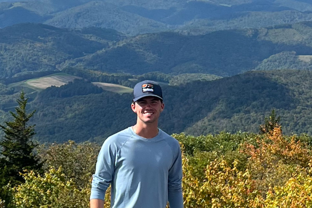
Ryan Sawyer ‘24, who is also co-majoring in Sustainability, created a geologic map and trail guide for Miami University’s natural areas
Environmental Earth Science major inspires to showcase Miami history through Oxford’s natural trails
Ryan Sawyer ‘24, who is also co-majoring in Sustainability, created a geologic map and trail guide for Miami University’s natural areas
Ryan Sawyer developed a passion for the environment starting back in his high school AP environmental science class. This made his choice to study Environmental Earth Science and Sustainability at Miami pretty simple.
As an undergraduate assistant for Brian Currie, professor of Geology and Environmental Earth Science, Sawyer was offered the idea of starting an undergraduate research program to benefit his future career, develop his skill set, and assist and notify Oxford residents of the geologic history that surrounds them.
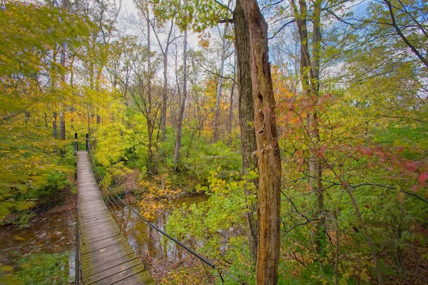
Swinging rope bridge on the Harkers Run Trail
Currie became Sawyer’s mentor on his project to make a geological map of Oxford’s natural trails. Although the map is not digitally available yet, Sawyer conducted most of the research during last summer and says they plan to provide QR codes at the trailheads to give students, residents, and visitors a walking tour.
“The initial steps were to do the online mapping of the trail system areas that we were focusing on, and so I was lucky enough to just do that from home for most of the summer,” Sawyer said. “Then I came back in early August, moved in early, and then we started doing fieldwork together.”
Sawyer explained that working with the tight-knit group of Environmental Earth Science majors within his department worked out for him in the end. It allowed him to develop a relationship with Currie, who has taught several of his classes. Geology professor and chair Jason Rech also helped Sawyer by providing more guidance, when and wherever it was needed.
Sawyer hopes that his project will make an impact throughout Miami and the Oxford area. He expressed how much geologic history goes unnoticed and unappreciated, simply because people do not know about it. This is something that he hopes to change.
“It's mostly just public education like in any sort of state park or national area you go to,” Sawyer said. “There's always little information plaques or trail guides about the landscape, so that's pretty much what we did on a smaller scale.”
Sawyer gained practice for building the trail guide by using the geographic information system (GIS) software packages QGIS and ArcMap to help with spatial analysis and to map the boundaries between geological units. Because this was really his first time doing actual research, he was surprised at the level of depth and detail required at each step. He credits Currie for helping him develop a work ethic as a solid foundation.
Sawyer recently presented his research poster at the Geologic Society for America convention in Pittsburgh. He considers this opportunity to be one of the highlights of the entire project.
“I'll go to grad school at some point, but the reason I'm not going right after I graduate is because I don't know what I want to specifically focus on yet,” Sawyer said. “I'll probably just do environmental consulting for a little bit more and then decide.”
Take a look at the Miami University Natural Areas Trails virtual map, which includes places of interest, trailheads, and trail types.